. The numbers, 3, 1, and 20, are marked on the hill but are otherwise unidentifiable. Circles show the locations of the windmills to the north (left) and south (right) of the site.
Duke Street is named as Quarry Hill, and Park Gate is marked where St James' Church currently stands.")
)
)
)
)
)
)
)
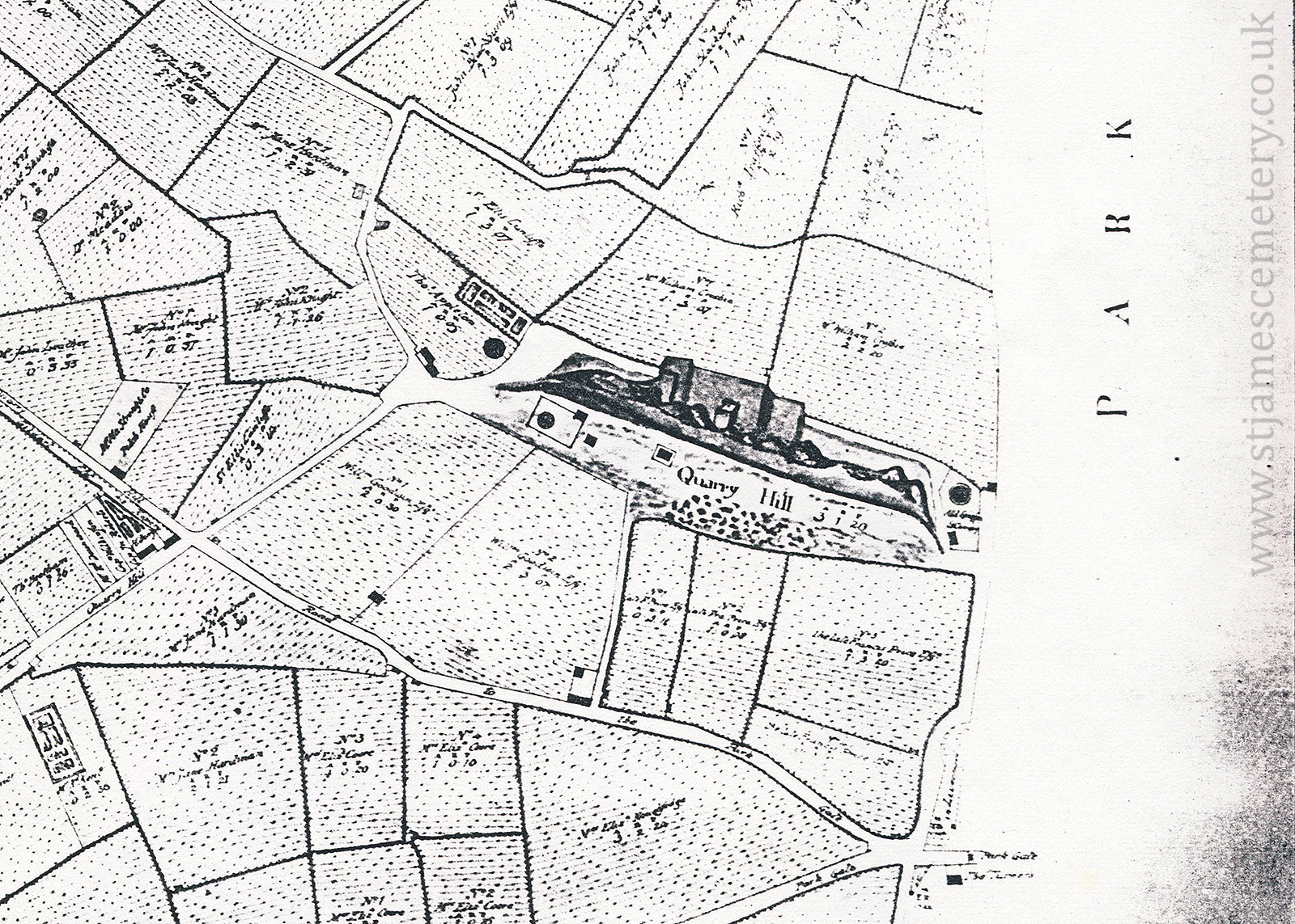
1765 Map
This map from 1765 shows the quarry and Quarry Hill surrounded by fields, with Toxteth Park to the south (right). The numbers, 3, 1, and 20, are marked on the hill but are otherwise unidentifiable. Circles show the locations of the windmills to the north (left) and south (right) of the site.
Duke Street is named as Quarry Hill, and "Park Gate" is marked where St James' Church currently stands.