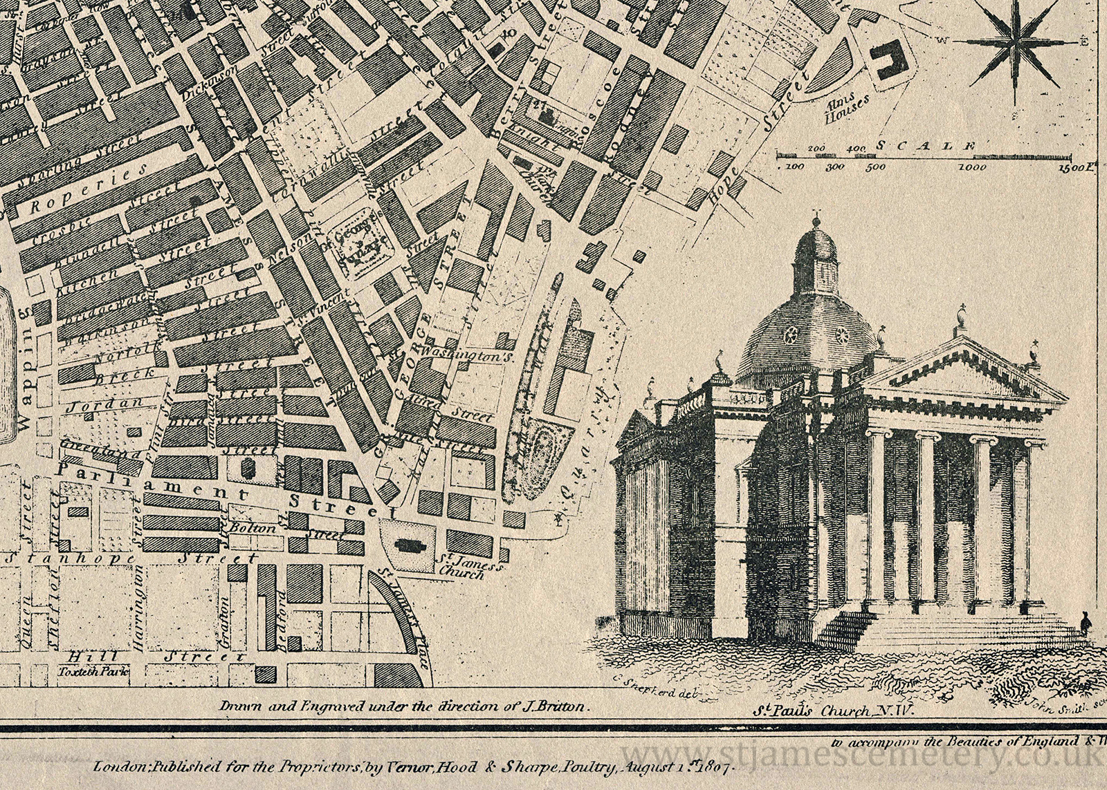
 of the quarry. There is a large illustration of St Paul's Church to the east (right) of the quarry where the map ends. Hope Street does not yet extend along the east side of the quarry site.
Drawn and engraved under the direction of J. Britton
Engraved by J. Roper from a drawing by G. Cole
London: Published for the Proprietors, by Vernor, Hood & Sharpe, Poultry, August 1st 1807.")
)
)
)
)
)
)
)
1807 Map
This map shows the quarry with St James' Walk and Mount, and the buildings on the mount. St James' Church is at the corner of Parliament Street and St James' Street. St Mark's Church is shown to the north (top) of the quarry. There is a large illustration of St Paul's Church to the east (right) of the quarry where the map ends. Hope Street does not yet extend along the east side of the quarry site.
Drawn and engraved under the direction of J. Britton
Engraved by J. Roper from a drawing by G. Cole
London: Published for the Proprietors, by Vernor, Hood & Sharpe, Poultry, August 1st 1807.